Crime & Safety
Severe Weather Coming to Hopkins Later Today
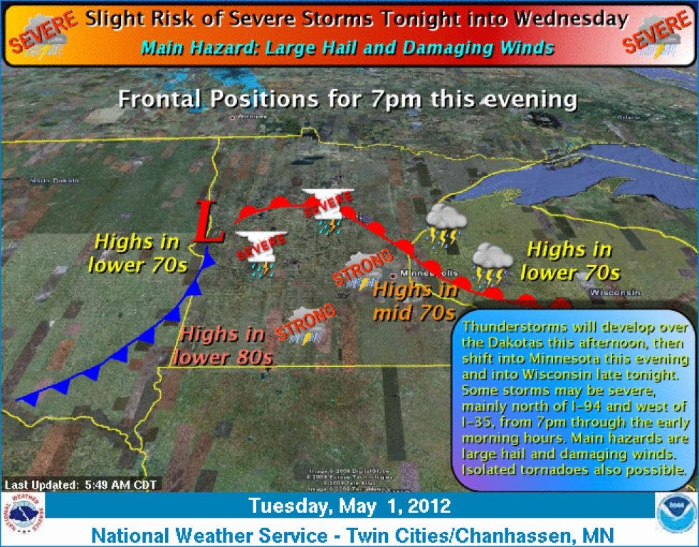
Thunderstorms should develop late this afternoon, bringing the chance of hail, damaging winds and tornadoes.

Once again, severe weather is expected to hit Hopkins.
The National Weather Service has issued a hazardous weather outlook for the Twin Cities. Thunderstorms should develop late this afternoon over central and western Minnesota, carrying a slight risk of severe thunderstorms.
The main hazards will be hail and damaging winds, with the possibility of isolated tornadoes that should be confined along and north of Interstate 94.
Find out what's happening in Hopkinswith free, real-time updates from Patch.
The overall severe weather threat will be greatest west of Interstate 35, starting after 7 p.m. and continuing through the early morning.
The severe weather will be triggered by a warm front moving in, as temperatures are expected to be in the high-70s to low-80s, with high humidity as well. More thunderstorms are expected Wednesday morning.
Find out what's happening in Hopkinswith free, real-time updates from Patch.
Visit this federal resource for tips to stay safe during natural disasters, and stay tuned to Patch for storm updates.
Stay up to date on all your local news. Sign up for the free Hopkins Patch newsletter, like us on Facebook and follow us on Twitter and Editor James Warden's Pinterest boards. Do you own a local business? to learn about five easy ways your business can use Patch.
Get more local news delivered straight to your inbox. Sign up for free Patch newsletters and alerts.


